
Check out the live text-chat for this problem that happened on Wednesday, February 13, 2019 from 3:00 – 4:30 p.m. ET with the problem author in the “Comments” section below!
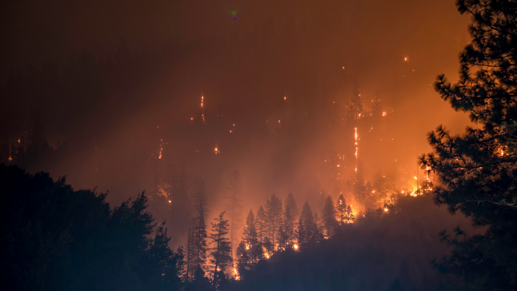
Glacier National Park is a popular tourist destination for hikers and campers in the summer. Many of the campsites in the park are accessible only on foot, and most require a substantial amount of hiking and/or climbing to reach. While this can be idyllic for outdoor enthusiasts, it can also be hazardous during drought summers. On August 10, 2017, a forest fire was spotted burning near Lake McDonald in the southwestern portion of the park. On August 12, 2017, another fire started near Logging Lake in the northwest part of the park. To date these fires have burned more than 20,000 acres, causing the evacuation and closure of at least 8 back-country campgrounds and numerous trails.
This poses an interesting challenge for park officials. During late August, all back-country campgrounds are filled to near capacity. Since there is little cell coverage in the park, there is virtually no way to contact campground occupants apart from visiting them in person. Federal law (and local trail conditions) prohibits the use of wheeled or motorized vehicles in the back-country. In the event of a fire, all back-country campers need to be evacuated from the park, presumably by hiking to a location where they can be transported by bus to safety. What is the best way to facilitate the evacuation of campgrounds that are only accessible by foot? How long should an evacuation be expected to take? From which of the ranger stations should evacuation teams be dispatched in order to vacate each campground?
Your task in this problem is to propose an evacuation plan for each of the park regions in the event of a fire. Assume that rescue teams can be dispatched from each of the five backcountry permit offices (Apgar, Two Medicine, Many Glacier, St. Mary, and Polebridge). You should specify which ranger station(s) should dispatch which team(s) and provide estimates on how many evacuation crews should be dispatched and how long evacuation will take.
Remember:
- The National Park Service does not have unlimited resources.
- In rough terrain, there are limits as to how far hikers can be expected to travel in a single day.
The following links may help you get started:
- https://www.nps.gov/glac/planyourvisit/upload/Backcountry-Map-Web.pdf
- https://www.nps.gov/glac/planyourvisit/backcountry.htm
The problem originates from use in the 24-hour Math Modeling Challenge (24MMC) 2017, a modeling competition for undergraduates. For more information about the 24MMC, contact Ben Galluzzo.
Problem Author: Dr. Ted Wendt, Carroll College
Reference and other links included on this page were current and valid at time of original posting; if they are no longer valid or live please look for similar or updated links in context with the referenced topic.